Pulaski County
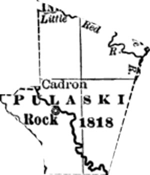
Pulaski County is the most populous county in Arkansas and home of the state capitol at Little Rock. The county was established on December 15, 1818, by the Missouri Territorial Legislature and is named for Count Casimir Pulaski, a Polish volunteer during the American Revolution. Pulaski is one of the five original counties forming Arkansas Territory in 1819. Many settlers came to the area from Missouri and Memphis following the Southwest Trail in the nineteenth century.
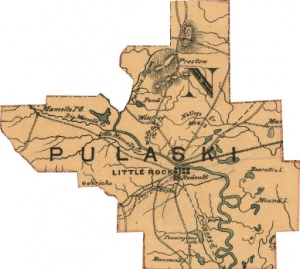
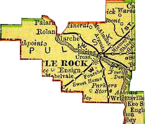
The county is bisected from northwest to southeast by the Arkansas River. The eastern part of the county sits in the flat Arkansas River valley plains. The western portion of the county is dominated by the foothills of the Ouachita Mountains, including the cone-shaped Pinnacle Mountain. The cities of Little Rock and North Little Rock sit astride what was once a natural ford of the Arkansas River along the Southwest Trail to Texas. The bluff on the south side of the river protected the city of Little Rock from flooding. Neighboring counties include Faulkner County, Lonoke County, Jefferson County, Grant County, Saline County, and Perry County.
Contents
History
The earliest known inhabitants in the area of Pulaski County were the Plum Bayou People, a mound building civilization with remnants still visible at Toltec Mounds east of the city of Little Rock. Around 1500 the Quapaw Indians began hunting in the region.
The first European explorer in what was to become Pulaski County was Frenchman Jean-Baptise Bénard de la Harpe who by tradition in February 1722 named two rocky outcroppings along the Arkansas River "La Petite Roche" (the "Little Rock") and "La Grande Roche" (the "Big Rock"). De la Harpe traded goods with local Quapaw Indians. The Quapaw (Ugahxpa, or "Downstream People") are a Native American tribe that may have migrated from the Ohio River Valley to the Lower Mississippi and Arkansas River valleys before the time of European settlement.
The first white settlers to the county may have been a party from the Carolinas led by John Gozel in 1806. The next year brothers John Pyeatt and Jacob Pyeatt settled at the present site of Crystal Hill, calling their settlement Pyeattstown. In 1820 Cadron Settlement became the official seat of government in the county. That same year the U.S. Post Office established mail service to both Cadron and Crystal Hill.
Pulaski County has lost significant territory since its organization on December 15, 1818, as part of Missouri Territory. Counties cleaved away from original Pulaski territory include Crawford County (in 1820), Conway County (1820), Jefferson County (1829), Scott County (1833), White County (1835), Saline County (1835), Prairie County (1846), Faulkner County (1873), and Lonoke County (1873).
In 1821 Arkansas territorial administration shifted from Arkansas Post to Little Rock. In March 1822 Little Rock became the county seat of Pulaski County, and the state capitol in 1836. The county benefited from its location on the Arkansas River, which was accessible by steamboats. By 1830 the city welcomed about one steamboat each week. On the eve of the Civil War the city averaged ten such visits each week. Antebellum Pulaski County thrived on an economy based on corn and cotton exports to New Orleans.
During the Civil War the county witnessed military and civilian activity. In February 1861 the Little Rock Arsenal was attacked by Confederate forces and its store of ammunition, cannon, and other weapons seized. Under the leadership of Major General Samuel R. Curtis 22,000 Union soldiers feigned an attack on Little Rock in May 1862, causing the state legislature to disband. The city was captured in September 1863 by fourteen thousand federal troops under the command of Major General Frederick Steele. After the loss of Little Rock, state representatives established a new state capitol in Washington, Hempstead County.
In 1872 the county was the location of the infamous Brooks-Baxter War between rival gubernatorial candidates Elisha Baxter and Joseph Brooks. Baxter was elected and inaugurated on January 6, 1873, but found himself in U.S. Circuit Court accused of fraud by Brooks and a coalition of party representatives. Baxter was eventually exonerated by President U.S. Grant, but lost his seat in November 1874 when a convention drew up a new state constitution.
Pulaski County's economy continued to depend on cash crops in the late nineteenth century, but expanded to include many other specialized commercial activities. Jim Crow segregation also expanded.
Geography
Pulaski County, 771 square miles in extent, is composed of flat Arkansas River Valley delta farmlands in the east, rolling hills to the south, and Ouachita mountain foothills to the west. The western part of the county is dominated by Lake Maumelle and Pinnacle Mountain State Park.
Transportation infrastructure
Economy
The largest employers in the county are the University of Arkansas for Medical Sciences, Baptist Health, Little Rock Air Force Base, Little Rock School District, ALLTEL, Arkansas Children's Hospital, Pulaski County Special School District, Veterans Hospital, Wal-Mart, St. Vincent Infirmary Medical Center, Acxiom, Dillard's, the University of Arkansas at Little Rock, Southwestern Bell Telephone Company, Kroger Food Stores, North Little Rock School District, Dassault Falcon Jet Corporation, Union Pacific Railroad, Arkansas Blue Cross & Blue Shield, L'Oreal, the Arkansas Democrat-Gazette, United Parcel Service, Molex, Maverick Transportation, Nuvell Financial Services, Target, Stephens Inc., Regions Bank, Pulaski Technical College, Raytheon Aircraft Company, Entergy Arkansas, Flake-Wilkerson Market Insights, Affiliated Foods Southwest, Heritage Company, ABF Freight System, Arkansas Heart Hospital, Rebsamen Medical Center, Windstream Communications, Transamerica Life Insurance Company, and Sears Roebuck.
Pulaski County is highly urbanized, but many areas of the county remain agricultural. In 2005 the University of Arkansas Division of Agriculture estimated that 118,426 acres of the county remained in farmland. According to the USDA the county contained 195,843 acres of timberlands in 2005. The county has 575 farms, making for an average farm size of 206 acres.
In 2005 the USDA estimated that 61,422 acres of cropland was harvested in the county. Soybeans accounted for 31,500 acres of harvested cropland in 2005; rice accounted for 4,800 acres. The inventory of cattle and calves in the county in 2002 stood at 8,778, the inventory of hogs stood at 487, and the inventory of laying hens was 663.
Law, government, and politics
County government came to Pulaski County on May 24, 1819, with a first session at the home of Samuel McHenry. In 1820 the first General Assembly of Arkansas Territory located county government in the town of Cadron at the outlet of Cadron Creek along the Arkansas River near Conway.
Little Rock today is the county seat of Pulaski County as well as the state capitol of Arkansas. The Pulaski County Courthouse is located at 401 West Markham Street in Little Rock. The county judge is Floyd G. "Buddy" Villines. The circuit/county clerk is Pat O'Brien. The county sheriff is Doc Holladay. The county treasurer is Debra Buckner. The county assessor is Janet Troutman Ward.
Education
Pulaski County is the home to several institutions of higher education including the University of Arkansas Medical School, the University of Arkansas at Little Rock, the Bowen School of Law, and Pulaski Technical College.
The county has nineteen public and private high schools:
- Catholic High School for Boys (Little Rock)
- Central Arkansas Christian High School (North Little Rock)
- Central High School (Little Rock)
- Episcopal Collegiate School (Little Rock)
- Faith Christian School of Little Rock (Little Rock)
- Hall High School (Little Rock)
- Jacksonville High School (Jacksonville)
- J. A. Fair Systems Magnet High School (Little Rock)
- Joe T. Robinson High School (Little Rock)
- Lutheran High School (Little Rock)
- McClellan Magnet High School (Little Rock)
- Mills University Studies High School (Little Rock)
- Mount St. Mary Academy (Little Rock)
- North Little Rock High School (North Little Rock)
- North Pulaski High School (Jacksonville)
- Oak Grove High School (North Little Rock)
- Parkview Arts and Science Magnet High School (Little Rock)
- Pulaski Academy (Little Rock)
- Sylvan Hills High School (Sherwood)
Religion
Places of interest
The county is known for a large number of cultural and tourist attractions, includig the Little Rock Zoo, Arkansas Arts Center, Clinton Presidential Center, Arkansas State Capitol, Old State House, and River Market District.
Demographics
The 2007 U.S. Census population estimate for the county is 373,911. The population of the county is expected to grow to 376,396 by 2010. More than 88 percent of the adult residents have completed high school, and 30.8 percent have completed college. The average family size is 2.87. The home ownership rate is 61.4 percent, with median family income of $43,308.
Population:
- 1820 - 1,921
- 1830 - 2,395
- 1900 - 63,179
- 1970 - 287,189
- 1980 - 340,693
- 1990 - 349,660
- 2000 - 361,474
- 2005 - 366,463
Communities
Pulaski County has a number of incorporated cities within its boundaries: Cammack Village, Jacksonville, Little Rock, Maumelle, North Little Rock, Shannon Hills, Sherwood, and Wrightsville. An incorporated town in the county is Alexander. Notable unincorporated communities in the county are Hensley, Iron Springs, Roland, and Warsaw.
Other populated places in Pulaski County:
- Allendale Manor
- Alpine
- Amboy
- American Manor
- Applegate
- Arbor Cove
- Arrowhead Manor
- Autumnbrook
- Azalea Place
- Banty (historical)
- Barger Addition
- Baring Cross
- Base Line
- Baucum
- Berger
- Beverly Terrace
- Biddle
- Bingham
- Blue Hill
- Booker
- Breckenridge
- Bredlow Corner
- Brittain
- Brownwood Terrace
- Candlewood
- Cannongate Addition
- Catorce (historical)
- Charity (historical)
- Cloverdale
- College Station
- Colony West
- Crossroads (historical)
- Crystal Hill
- Deer Meadow
- Dickey (historical)
- Dixie
- Doe Branch
- Douglas Corner
- Douglasville
- Estes
- Eureka Garden
- Fairman
- Fairview
- Ferndale
- Fourche Dam (historical)
- Foxboro
- Galloway
- Gap Rancheros
- Geyer Springs
- Gibson
- Gillam Park
- Gladewood Addition
- Gravel Ridge
- Guilford (historical)
- Gum Springs
- Haig
- Halstead
- Head (historical)
- Hickory Hills
- Hickory Ridge
- Higgins
- Hillsborough
- Holly Springs
- Horace
- Hot Springs Junction
- Indian Head Lake Estates
- Ironton
- Ivesville
- Jeffrey
- Kensington Place
- Lakewood
- Landmark
- Lansbrook
- Lecont
- Levy
- Longlea
- Lundsford Corner
- Mabelvale
- Macon
- Marche
- Maumelle Station
- McAlmont
- McClellan Place
- Meadowcliff
- Melanie Park
- Merrivale
- Mesa View
- Mineral (historical)
- Monnie Springs
- Morgan
- Mount Pilgrim
- Natural Steps
- Niemeyer (historical)
- North Hills Manor
- North Oaks
- North Point
- Oak Forest
- Oak Grove
- Olmstead
- Otter Creek
- Overlook Park
- Pankey
- Park Hill
- Parker's Store
- Parkway Place
- Pebble Beach Park
- Pecan Grove
- Pecan Lake
- Picron
- Piedmont
- Pinnacle
- Pleasant Forest
- Pleasant Ridge
- Pleasant Valley
- Pleasant Valley Estates
- Pleasant View
- Ponderosa
- Protho Junction
- Pulaski
- Pulaski Heights
- Rainwood
- Red Gate
- River Ridge Manor
- Rixey
- Rock Creek
- Rolling Hills
- Rose City
- Rosedale
- Rottaken
- Rusty Pines
- Saint Charles
- Saint Thomas
- Secluded Hills
- Shady Grove
- Sheraton Park
- Shiloh
- Silver Creek
- Skylark
- Spring Valley
- Sweet Home
- Sylvan Hills
- Tafton
- Tall Timbers West
- Tanglewood
- Terrytown
- Timber Creek
- Timber Ridge
- Toneyville
- Totten
- Town and Country Estates
- Turtle Creek
- Twin Springs
- Valentine
- Wakefield Village
- Walton Heights
- Wampoo
- Ward
- West Marche
- Westbrook
- Westbrook Addition
- Western Acres
- Westwood
- Willowdale (historical)
- Windamere
- Woodland Heights
- Woodland Hills
- Woodland Ridge
- Woodson
- Woodyardville
- Wye
- Yorkwood
- Zion Hill
References
- David W. Baird, The Quapaw Indians: A History of the Downstream People, (Norman: University of Oklahoma Press, 1980).
- S. Charles Bolton, "Under Three Flags," in A Documentary History of Arkansas, eds. C. Fred Williams, et al. (Fayetteville: University of Arkansas Press, 1984), p. 3-5.
- Isaac Joslin Cox, ed., The Journeys of René-Robert Cavelier, Sieur de La Salle, vol. 1 (New York: Allerton Book Company, 1922).
- John Hugh Reynolds, ed., "Marquette's Reception by the Quapaws, 1673," Publications of the Arkansas Historical Association 1 (1906): 500-502.
- Ralph A. Smith, ed. "Exploration of the Arkansas River by Bénard de la Harpe, 1721-1722: Extracts from His Journal and Instructions," Arkansas Historical Quarterly 10 (1951): 347-357.
- Paulette Walker and Alan Paulson, Historic Pulaski County: Arkansas (Arcadia Publishing, 1999).


