Difference between revisions of "Conway County"
(→Education) |
|||
| (24 intermediate revisions by the same user not shown) | |||
| Line 1: | Line 1: | ||
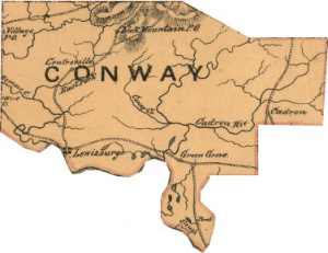
| − | '''Conway County''' is a county political unit in central Arkansas formed | + | [[Image:Conway-county-1864.jpg|thumb|Conway County in 1864.]] |
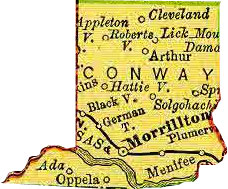
| + | [[Image:Conway-county-1895.jpg|thumb|Conway County in 1895.]] | ||
| + | '''Conway County''' is a county political unit in central Arkansas formed on October 20, 1825, from land taken from historic [[Pulaski County]]. The county is named for [[Henry Wharton Conway]], Arkansas territorial delegate to the U.S. Congress. Scenic [[Petit Jean Mountain]] is a popular local and regional tourist destination. Neighboring counties include Van Buren County, [[Faulkner County]], [[Perry County]], Yell County, and Pope County. | ||
====History==== | ====History==== | ||
| Line 7: | Line 9: | ||
====Geography==== | ====Geography==== | ||
| − | Conway County comprises 556 square miles of territory. The county is characterized by farmlands, cattle ranches, thick pine forests, Ozark and Ouachita foothills mountain ranges, mountains, and lakes. The county is drained in the south by the [[Arkansas River]] and [[Cadron Creek | + | Conway County comprises 556 square miles of territory. The county is characterized by farmlands, cattle ranches, thick pine forests, Ozark and Ouachita foothills mountain ranges, mountains, and lakes. The county is drained in the south by the [[Arkansas River]] and [[Cadron Creek]]. [[Cedar Falls]] is among the tallest waterfalls in the American South. Two notable lakes in the county are [[Overcup Lake]] and [[Brewer Lake]]. Brewer Lake is the water supply for the city of [[Conway]]. |
====Transportation infrastructure==== | ====Transportation infrastructure==== | ||
| − | [[Interstate 40]] passes east-west through the southern part of the county. [[U.S. Highway 64]] parallels the interstate just to the south, and passes through Menifee, Plumerville, Morrilton, Kenwood, and Blackwell. Scenic [[Arkansas Highway 9]] passes through the county from the northeast to the southwest, passing through Center Ridge, Birdtown, Solgohachia, Overcup, Morrilton, and Oppelo. | + | [[Interstate 40]] passes east-west through the southern part of the county. [[U.S. Highway 64]] parallels the interstate just to the south, and passes through [[Menifee]], [[Plumerville]], [[Morrilton]], [[Kenwood]], and [[Blackwell]]. Scenic [[Arkansas Highway 9]] passes through the county from the northeast to the southwest, passing through [[Center Ridge]], [[Birdtown]], [[Solgohachia]], [[Overcup]], Morrilton, and [[Oppelo]]. |
====Economy==== | ====Economy==== | ||
| + | |||
| + | The largest employers in Conway County are [[Green Bay Packaging]], [[ICT Group]], the [[South Conway County Public School District]], [[Wal-Mart]], [[Telex Communications]], [[St. Anthony's Healthcare Center]], [[University of Arkansas Community College at Morrilton]], [[Wayne Smith Trucking]], [[Winrock International]], [[Arch Ford Educational Services Coop]], [[Morrilton Healthcare Center]], [[Petit Jean State Park]], the [[Wonderview Public School District]], [[Hixson Lumber Sales]], and the Coca-Cola Bottling Company. | ||
====Law, government, and politics==== | ====Law, government, and politics==== | ||
| − | The county judge is Jimmy Hart. | + | The [[Conway County Courthouse]] is located in [[Morrilton]]. The county judge is Jimmy Hart. |
====Education==== | ====Education==== | ||
| Line 27: | Line 31: | ||
====Places of interest==== | ====Places of interest==== | ||
| − | Many visitors to the country come for the natural beauty and recreational facilities at [[Petit Jean State Park]]. The park is considered the "flagship" of the state's extensive park system. The park is known for natural features like [[Cedar Falls]], [[Bear Cave]], and [[Rock House Cave]]. Other places of interest on top of Petit Jean Mountain are [[Winrock Farms]] and the [[ | + | Many visitors to the country come for the natural beauty and recreational facilities at [[Petit Jean State Park]]. The park is considered the "flagship" of the state's extensive park system. The park is known for natural features like [[Cedar Falls]], [[Bear Cave]], and [[Rock House Cave]]. Other places of interest on top of Petit Jean Mountain are [[Winrock Farms]] and the [[Museum of Automobiles]]. |
====Demographics==== | ====Demographics==== | ||
| Line 40: | Line 44: | ||
====Communities==== | ====Communities==== | ||
| − | Conway County has three incorporated cities within its boundaries: [[Morrilton]], [[Oppelo]], and [[Plumerville]]. It has one incorporated town: Menifee. | + | Conway County has three incorporated cities within its boundaries: [[Morrilton]], [[Oppelo]], and [[Plumerville]]. It has one incorporated town: [[Menifee]]. |
Other populated places in Conway County: | Other populated places in Conway County: | ||
| − | *Ada | + | *[[Ada]] |
*Arthur | *Arthur | ||
*Austin | *Austin | ||
*Bethlehem | *Bethlehem | ||
| − | *Birdtown | + | *[[Birdtown]] |
| − | *Blackwell | + | *[[Blackwell]] |
*Blick | *Blick | ||
*Catholic Point | *Catholic Point | ||
*Cedar Creek | *Cedar Creek | ||
| − | *Center Ridge | + | *[[Center Ridge]] |
*Clebb (historical) | *Clebb (historical) | ||
| − | *Cleveland | + | *[[Cleveland]] |
*Country Estates | *Country Estates | ||
*Cypress Valley | *Cypress Valley | ||
| Line 63: | Line 67: | ||
*Gobblers Point | *Gobblers Point | ||
*Grandview | *Grandview | ||
| − | *Hattieville | + | *[[Hattieville]] |
*Hickory Hill | *Hickory Hill | ||
*Hill Creek | *Hill Creek | ||
*Holly Springs | *Holly Springs | ||
*Index (historical) | *Index (historical) | ||
| − | *Jerusalem | + | *[[Jerusalem]] |
| − | *Kenwood | + | *[[Kenwood]] |
*Lanty | *Lanty | ||
| − | *Lewisburg | + | *[[Lewisburg]] |
*Lick Mountain | *Lick Mountain | ||
*Lone Grove | *Lone Grove | ||
| Line 81: | Line 85: | ||
*Northview Subdivision | *Northview Subdivision | ||
*Old Hickory | *Old Hickory | ||
| − | *Overcup | + | *[[Overcup]] |
*Pleasant Hill | *Pleasant Hill | ||
| − | *Pontoon | + | *[[Pontoon]] |
*Rehms Corner | *Rehms Corner | ||
*Riverview | *Riverview | ||
*Robertsville | *Robertsville | ||
| − | *Saint Vincent | + | *[[Saint Vincent]] |
*Sandtown (historical) | *Sandtown (historical) | ||
| − | *Solgohachia | + | *[[Solgohachia]] |
*Spring Meadows | *Spring Meadows | ||
| − | *Springfield | + | *[[Springfield]] |
*Sunnyside | *Sunnyside | ||
*Wesley Chapel | *Wesley Chapel | ||
| Line 102: | Line 106: | ||
==External links== | ==External links== | ||
| + | |||
| + | *[http://arkansasedc.com/media/38290/Conway_01_2007.pdf Arkansas Economic Development Commission - Largest Employers in Conway County] | ||
[[Category:Counties]] | [[Category:Counties]] | ||
Latest revision as of 06:34, 14 April 2010
Conway County is a county political unit in central Arkansas formed on October 20, 1825, from land taken from historic Pulaski County. The county is named for Henry Wharton Conway, Arkansas territorial delegate to the U.S. Congress. Scenic Petit Jean Mountain is a popular local and regional tourist destination. Neighboring counties include Van Buren County, Faulkner County, Perry County, Yell County, and Pope County.
Contents
History
Conway County was established on October 20, 1825, from lands carved away from historic Pulaski County.
Geography
Conway County comprises 556 square miles of territory. The county is characterized by farmlands, cattle ranches, thick pine forests, Ozark and Ouachita foothills mountain ranges, mountains, and lakes. The county is drained in the south by the Arkansas River and Cadron Creek. Cedar Falls is among the tallest waterfalls in the American South. Two notable lakes in the county are Overcup Lake and Brewer Lake. Brewer Lake is the water supply for the city of Conway.
Transportation infrastructure
Interstate 40 passes east-west through the southern part of the county. U.S. Highway 64 parallels the interstate just to the south, and passes through Menifee, Plumerville, Morrilton, Kenwood, and Blackwell. Scenic Arkansas Highway 9 passes through the county from the northeast to the southwest, passing through Center Ridge, Birdtown, Solgohachia, Overcup, Morrilton, and Oppelo.
Economy
The largest employers in Conway County are Green Bay Packaging, ICT Group, the South Conway County Public School District, Wal-Mart, Telex Communications, St. Anthony's Healthcare Center, University of Arkansas Community College at Morrilton, Wayne Smith Trucking, Winrock International, Arch Ford Educational Services Coop, Morrilton Healthcare Center, Petit Jean State Park, the Wonderview Public School District, Hixson Lumber Sales, and the Coca-Cola Bottling Company.
Law, government, and politics
The Conway County Courthouse is located in Morrilton. The county judge is Jimmy Hart.
Education
Morrilton is home to the University of Arkansas Community College at Morrilton. The county has four public and private high schools: Morrilton High School (Morrilton), Nemo Vista High School (Center Ridge), Sacred Heart High School (Morrilton), and Wonderview High School (Hattieville).
Religion
Places of interest
Many visitors to the country come for the natural beauty and recreational facilities at Petit Jean State Park. The park is considered the "flagship" of the state's extensive park system. The park is known for natural features like Cedar Falls, Bear Cave, and Rock House Cave. Other places of interest on top of Petit Jean Mountain are Winrock Farms and the Museum of Automobiles.
Demographics
According to the U.S. Census Bureau the 2000 population of Conway County was 20,336.
- 1980 - 19,362
- 1990 - 19,151
- 2000 - 20,336
- 2005 - 20,739
Communities
Conway County has three incorporated cities within its boundaries: Morrilton, Oppelo, and Plumerville. It has one incorporated town: Menifee.
Other populated places in Conway County:
- Ada
- Arthur
- Austin
- Bethlehem
- Birdtown
- Blackwell
- Blick
- Catholic Point
- Cedar Creek
- Center Ridge
- Clebb (historical)
- Cleveland
- Country Estates
- Cypress Valley
- Deerwood
- Divide (historical)
- Friendship
- Gobblers Point
- Grandview
- Hattieville
- Hickory Hill
- Hill Creek
- Holly Springs
- Index (historical)
- Jerusalem
- Kenwood
- Lanty
- Lewisburg
- Lick Mountain
- Lone Grove
- Lost Corner
- Macedonia
- McClaren
- Middleton
- North Hills Subdivision
- Northview Subdivision
- Old Hickory
- Overcup
- Pleasant Hill
- Pontoon
- Rehms Corner
- Riverview
- Robertsville
- Saint Vincent
- Sandtown (historical)
- Solgohachia
- Spring Meadows
- Springfield
- Sunnyside
- Wesley Chapel
- West (historical)
- Winrock
- Wonderview
- Woolverton (historical)

