State of Arkansas
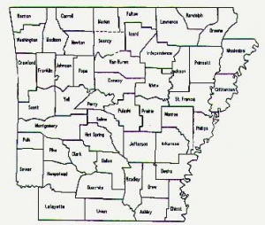
The State of Arkansas is located in the south-central part of the United States of America. Arkansas is bordered by Louisiana, Mississippi, Tennessee, Missouri, Oklahoma, and Texas. The state is commonly divided into six distinct geographical regions: the Mississippi Alluvial Plain, Crowley's Ridge, the Ozarks, the Arkansas River Valley, the Ouachita Mountains, the Gulf Coastal Plain.
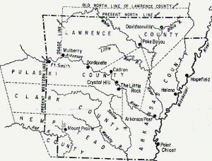
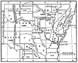
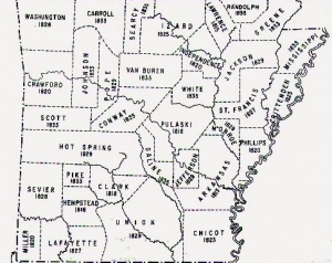
Arkansas was originally a part of the Louisiana Territory acquired from France in 1803. It later became part of Missouri Territory, and in 1813 most of what became the state formed Arkansas County, with Arkansas Post as the county seat. In 1819 the county became the Territory of Arkansas, with a capitol at Arkansas Post. In 1820 the territorial capitol moved to Little Rock.
Arkansas was admitted to the Union on June 15, 1836, with Little Rock as its state capitol. It was the twenty-fifth state to join the Union. Arkansas' admission to the United States is enshrined in the Constitution of 1836. The state had four subsequent constitutions in 1861, 1864, 1868, and 1874. The state today shares borders with Louisiana, Mississippi, Missouri, Oklahoma, Tennessee, and Texas.
Contents
- 1 Early Inhabitants
- 2 European Exploration
- 3 Permanent Settlement
- 4 Arkansas Territory
- 5 Statehood
- 6 Antebellum Arkansas
- 7 Civil War
- 8 Reconstruction
- 9 Progressive Era
- 10 World War I
- 11 Great Depression
- 12 World War II
- 13 Civil Rights Struggle
- 14 Demographics
- 15 State Departments, boards, commissions, committees, and councils
- 16 References
- 17 External links
Early Inhabitants
The earliest human inhabitants in the area of Arkansas may have been the Ozark Bluff Dwellers who began living in caves and under ledges along the White River around 8000 BC. They were followed by the Mound Builders who occupied the delta portions of eastern and southern Arkansas from around 600 to 1050 AD.
Prehistoric tribes:
Folsom people
Mississippian Indians
Plum Bayou culture
Historic tribes:
Caddo
The Caddo Indians of Texas occupied lands in western parts of Arkansas, particularly along the Red and Ouachita rivers.
Cahinnio
Cherokee
Chickasaw
Choctaw
Illinois
Kaskinampo
Michigamea
Mosopelea
Ofo
Osage
The Osage Indians held hunting lands in the northwestern part of Arkansas.
Quapaw
Europeans encountered the Quapaw (or "Arkansas") Indians. The Quapaw had migrated to the state from the upper Ohio River valley.
European Exploration
The conquistador Hernando de Soto entered Arkansas on June 18, 1541, possibly at Sunflower Landing. He was looking for gold.
In 1673 Jacques Marquette and Louis Joliet entered a Quapaw village at the mouth of the Arkansas River. In 1682 Robert Chevelier, Sieur de La Salle claimed the entire valley of the Mississippi River for France. He called the area "Louisiana" in honor of the absolute monarch Louis XIV.
Permanent Settlement
La Salle's associate Henri de Tonti founded Arkansas Post in 1686. The trading post was the first permanent European settlement on the western side of the Mississippi River. The French governed Arkansas from 1686 through 1766, when they relinquished all claims to Louisiana, including Arkansas Post, to Spain. Spain returned the territory, now containing 368 settlers, to France in 1800. The Arkansas area became part of the United States in the Louisiana Purchase of 1803. The District of Arkansas was created within the purchase in 1806. Arkansas became part of Missouri Territory in 1812 when Louisiana became a state.
French Governors of Louisiana
- Marquis de Sanville (1689-1700)
- Bienville (1701-1712)
- Lamothe Cadillar (1713-1715)
- De L'Epinay (1716-1717)
- Bienville (1718-1723)
- Boisbriant (interim, 1724)
- Perier (1725-1731)
- Bienville (1732-1741)
- Marquis de Vaudreuil (1742-1752)
- Baron de Kelerec (1753-1762)
- D'Abbadie (1763-1766)
Spanish Governors of Louisiana
- Antonio de Ulloa (1767-1768)
- Alexander O'Reilly (1768-1769)
- Luis de Unzaga (1770-1776)
- Bernando de Galvez (1777-1784)
- Estevan Miro (1785-1787)
- Francisco Luis Hortu, Baron of Carondelet (1789-1792)
- Gayoso de Lemos (1793-1798)
- Sebastian de Casa Calvo y O'Farrell (1798-1799)
- Juan Manual de Salcedo (1800-1803)
Louisiana Territorial Population:
- 1809 - 1,062
Arkansas Territory
The Territory of Arkansas was designated by the U.S. Congress on March 2, 1819, when an area roughly shaped like the present State of Arkansas was cleaved away from the Territory of Missouri. Arkansas Post was originally established as the seat of territorial government, but in 1820 the capitol was moved west to Little Rock.
Arkansas Territorial Censuses:
- 1820 - 14,273
- 1823 -
- 1829 -
- 1830 - 30,388
Statehood
Arkansas achieved statehood on June 15, 1836.
Antebellum Arkansas
Trail of Tears
Civil War
Reconstruction
Progressive Era
World War I
Great Depression
World War II
Civil Rights Struggle
Demographics
According to the U.S. Census Bureau the population of the state in 2005 was 2,779,154. The largest city in the state is Little Rock with a population of 184,081 in 2004.
Arkansas population:
- 1836 - 51,809 (9,838 black)
- 1840 - 97,574
- 1850 - 209,897
- 1860 - 435,450
- 1870 - 484,471
- 1880 - 802,525
- 1890 - 1,128,211
- 1900 - 1,311,564
- 1910 - 1,574,449
- 1920 - 1,752,204
- 1930 - 1,854,482
- 1940 - 1,949,387
- 1950 - 1,909,511
- 1960 - 1,786,272
- 1970 - 1,923,295
- 1980 - 2,286,435
- 1990 - 2,356,586
- 2000 - 2,678,668
- 2005 - 2,779,154
State Departments, boards, commissions, committees, and councils
- Abstractor's Board of Examiners
- State Board of Public Accountancy
- State Board of Acupuncture and Related Techniques
- Administrative Office of the Courts
- Department of Aeronautics
- Agriculture Department
- Alcoholic Beverage Control Board
- Alternative Dispute Resolution Commission
- Appraiser Licensing and Certification Board
- State Board of Architects
- Assessment Coordination Department
- State Athletic Commission
- State Board of Athletic Training
- Attorney General
- Auctioneers Licensing Board
- Auditor
- Aviation and Aerospace Commission
- Bail Bond Company and Bondsman Licensing Board
- State Bank Department
- State Board of Barber Examiners
- Beef Council
- Boll Weevil Eradication Foundation
- State Building Services
- Burial Association Board
- Capitol Arts and Grounds Commission
- Capitol Zoning District Commission
- Catfish Promotion Board
- Cemetery Board
- Child Abuse and Neglect Prevention Board
- Child Abuse, Rape, Domestic Violence Commission
- State Board of Chiropractic Examiners
- Civil Air Patrol
- State Claims Commission
- Code Revision Commission
- State Board of Collection Agencies
- Commemorative Commission
- Department of Community Correction
- Contractors Licensing Board
- Corn and Grain Sorghum Board
- Board of Correction and Community Punishment
- Department of Correction
- Corrections School System
- State Board of Cosmetology
- Board of Examiners in Counseling
- Court of Appeals Apportionment Commission
- Court of Appeals
- Court Reporters Licensing Board
- Crime Information Center
- State Crime Laboratory
- Crime Victims Reparations Board
- Criminal Detention Facility Review Committee
- Dairy Committee
- State Board of Dental Examiners
- Governors Development Disabilities Council
- Development Finance Authority
- Dietetics Licensing Board
- Early Childhood Commission
- Economic Development Commission
- Department of Education
- State Board of Education
- Educational Television Network
- State Board of Election Commissioners
- Board of Electrical Examiners of the State of Arkansas
- Elevator Safety Board
- State Board of Embalmers and Funeral Directors
- Department of Emergency Management
- State Employees Association
- Board of Registration for Professional Engineers and Land Surveyors
- Entertainers Hall of Fame Board
- Department of Environmental Quality
- Ethics Commission
- Executive Chief Information Officer
- Fair Housing Commission
- Department of Finance and Administration
- Board of Finance
- Fire Prevention Commission
- Fire Protection Licensing Board
- First Lady Ginger Beebe
- State Board of Registration for Foresters
- Forestry Commission
- Game and Fish Commission
- Geological Commission
- Board of Registration for Professional Geologists
- Governor's Commission on Global Warming
- Office of Governor
- Governors Advisory Council on Aging
- Governor's Commission on People with Disabilities
- Governor's Mansion
- Governor's Mansion Commission
- Board of Health Education
- Health Services Permit Agency
- Department of Health
- Board of Hearing Instrument Dispensers
- Heating, Ventilation, Air Conditioning and Refrigeration Licensing Board
- Department of Arkansas Heritage
- Department of Higher Education
- Highway and Transportation Department
- Highway Commission
- History Commission
- Home Inspector Registration Board
- House of Representatives
- Department of Human Services
- Information Network of Arkansas
- Department of Information Systems
- Office of Information Technology
- Insurance Department
- Interest on Lawyers' Trust Account Foundation Board
- State Board of Registered Interior Designers
- Judicial Discipline and Disability Commission
- Judiciary
- Keep Arkansas Beautiful Commission
- Kidney Disease Commission
- Department of Labor
- State Land Information Board
- State Board of Landscape Architects
- Commission on Law Enforcement Standards and Training
- State Board of Law Examiners
- Division of Legislative Audit
- Bureau of Legislative Research
- Legislature
- Arkansas State Library
- Office of the Lieutenant Governor
- Liquefied Petroleum Gas Board
- Livestock and Poultry Commission
- Local Police and Fire Retirement System
- Manufactured Home Commission
- Martin Luther King, Jr. Commission
- State Board of Massage Therapy
- State Medical Board
- Military Department, Arkansas National Guard
- Minority Health Commission
- Motor Vehicle Commission
- Commission on National and Community Service
- Natural and Cultural Resources Council
- Natural Heritage Commission
- Natural Resources Commission
- State Board of Nursing
- Oil and Gas Commission
- Board of Dispensing Opticians
- State Board of Optometry
- Department of Parks and Tourism
- Parks, Recreation, and Travel Commission
- State Board of Parole
- State Board of Pharmacy
- State Board of Physical Therapy
- State Plant Board
- State Podiatry Examining Board
- Pollution Control and Ecology Commission
- State Board of Private Career Education
- Board of Private Investigators and Private Security Agencies
- Board of Examiners in Psychology
- Public Defender Commission
- Public Employees Retirement System
- Public Service Commission
- Racing Commission
- Real Estate Commission
- Rehabilitation Services
- Rice Research and Promotion Board
- Rural Development Commission
- Department of Rural Services
- State Board of Registered Professional Sanitarians
- Savings and Loan Board
- Arkansas School for the Blind
- Arkansas School for the Deaf
- Science and Technology Authority
- Office of the Secretary of State
- Securities Department
- Senate
- Sentencing Commission
- Disability Determination for Social Security Administration
- Social Work Licensing Board
- State Board of Registration for Soil Classifiers
- Soybean Promotion Board
- Board of Examiners in Speech-Language Pathology & Audiology
- Spinal Cord Commission
- State Hospital
- Commissioner of State Lands
- State Police Commission
- State Police
- Student Loan Authority
- Supreme Court
- Teacher Retirement System
- Title Insurance Agents' Licensing Board
- Tobacco Control Board
- Tobacco Settlement Commission
- Towing and Recovery Board
- Transitional Employment Board
- Office of the Treasurer
- Department of Veteran Affairs
- Veterans Child Welfare Service
- Veterinary Medical Examining Board
- War Memorial Stadium Commission
- Commission on Water Well Construction
- Waterways Commission
- Wheat Promotion Board
- Workers Compensation Commission
- State Board of Workforce Education and Career Opportunities
- Department of Workforce Education
- Workforce Investment Board
- Department of Workforce Services
References
- David Yancey Thomas, Arkansas and Its People: A History, 1541-1930 (American Historical Society, 1930).
- C. Fred Williams, A Documentary History of Arkansas (Fayetteville: University of Arkansas Press, 1984), 1-5.


