File list
From FranaWiki
This special page shows all uploaded files.
| Date | Name | Thumbnail | Size | User | Description | Versions |
|---|---|---|---|---|---|---|
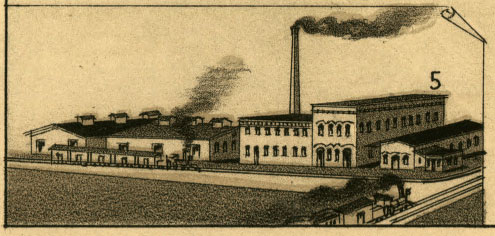
| 02:20, 11 October 2009 | Southern-oil-mills.jpg (file) |  |
41 KB | Phil | Southern Oil Mills in 1887. Source: ''Perspective Map of the City of Little Rock, Ark., State Capital of Arkansas, County Seat of Pulaski County'' (Milwaukee, WI: Beck & Pauli Lith. Co., 1887). In public domain. | 1 |
| 02:20, 11 October 2009 | School-blind-1887.jpg (file) |  |
32 KB | Phil | The Arkansas School for the Blind. Source: ''Perspective Map of the City of Little Rock, Ark., State Capital of Arkansas, County Seat of Pulaski County'' (Milwaukee, WI: Beck & Pauli Lith. Co., 1887). In public domain. | 1 |
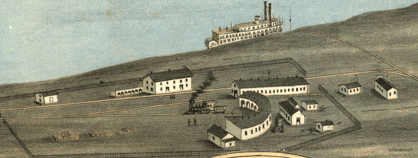
| 01:58, 11 October 2009 | Little-rock-memphis-rr.jpg (file) |  |
49 KB | Phil | Grounds of the Memphis and Little Rock Railroad in North Little Rock, Arkansas. Source: A. Ruger, ''Bird's Eye View of the City of Little Rock, the Capitol of Arkansas'' (A. Ruger, 1871). Drawing in public domain. | 1 |
| 01:05, 11 October 2009 | Dcantillon.jpg (file) |  |
78 KB | Phil | D'Cantillon and D'Cantillon Addition in North Little Rock, Arkansas. Source: Rickon, Gibb, and Duff, ''Map of the city of Little Rock and Argenta, Arkansas: Compiled from Official Sources and Actual Surveys'' (Little Rock, Arkansas: Rickon, Gibb & Duff, 1 | 1 |
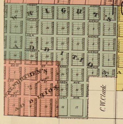
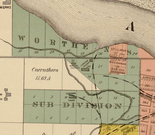
| 00:12, 11 October 2009 | Wrights-worthens-adds.jpg (file) |  |
66 KB | Phil | Wright's and Worthen's addition. From Rickon, Gibb & Duff, ''Map of the City of Little Rock and Argenta, Arkansas: Compiled from Official Sources and Actual Surveys'' (1888). Map in public domain. | 1 |
| 00:12, 11 October 2009 | Worthens-subdivision.jpg (file) |  |
68 KB | Phil | Worthen's Subdivision. From Rickon, Gibb & Duff, ''Map of the City of Little Rock and Argenta, Arkansas: Compiled from Official Sources and Actual Surveys'' (1888). Map in public domain. | 1 |
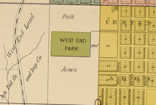
| 00:12, 11 October 2009 | West-end-park-map.jpg (file) |  |
58 KB | Phil | West End Park. From Rickon, Gibb & Duff, ''Map of the City of Little Rock and Argenta, Arkansas: Compiled from Official Sources and Actual Surveys'' (1888). Map in public domain. | 1 |
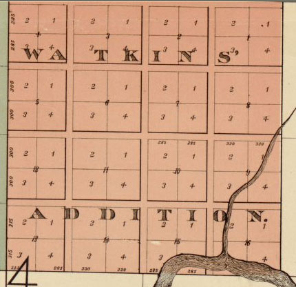
| 00:11, 11 October 2009 | Watkins-add-map.jpg (file) |  |
42 KB | Phil | Watkin's Addition. From Rickon, Gibb & Duff, ''Map of the City of Little Rock and Argenta, Arkansas: Compiled from Official Sources and Actual Surveys'' (1888). Map in public domain. | 1 |
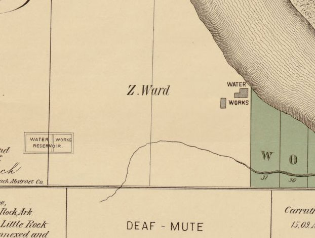
| 00:11, 11 October 2009 | Water-works-reservoir.jpg (file) |  |
46 KB | Phil | Location of the Little Rock Water Works and Reservoir in 1888. From Rickon, Gibb & Duff, ''Map of the City of Little Rock and Argenta, Arkansas: Compiled from Official Sources and Actual Surveys'' (1888). Map in public domain. | 1 |
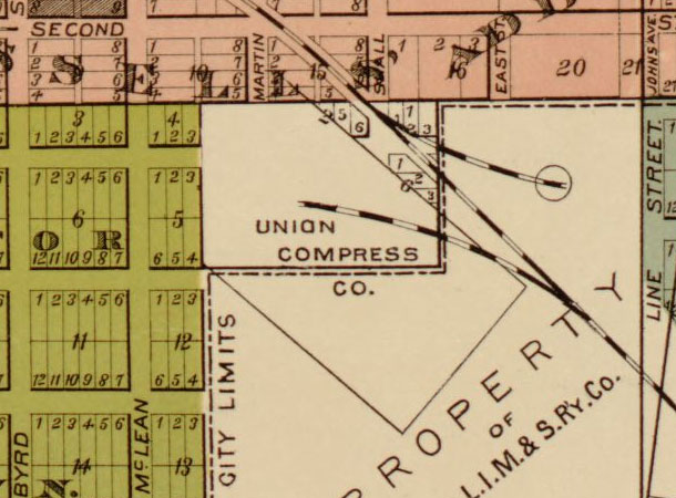
| 00:11, 11 October 2009 | Union-compress-co-map.jpg (file) |  |
68 KB | Phil | Union Compress Company grounds. From Rickon, Gibb & Duff, ''Map of the City of Little Rock and Argenta, Arkansas: Compiled from Official Sources and Actual Surveys'' (1888). Map in public domain. | 1 |
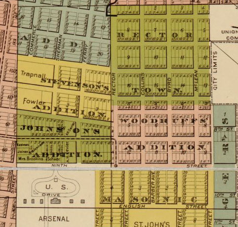
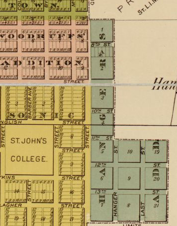
| 00:10, 11 October 2009 | Steven-john-wood-rector-add.jpg (file) |  |
86 KB | Phil | Stevenson's, Johnson's, Woodruffs', and Rector Town additions. From Rickon, Gibb & Duff, ''Map of the City of Little Rock and Argenta, Arkansas: Compiled from Official Sources and Actual Surveys'' (1888). Map in public domain. | 1 |
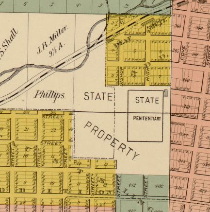
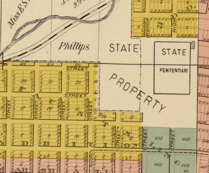
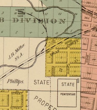
| 00:08, 11 October 2009 | State-penitentiary-map.jpg (file) |  |
62 KB | Phil | Grounds of the Arkansas State Penitentiary. From Rickon, Gibb & Duff, ''Map of the City of Little Rock and Argenta, Arkansas: Compiled from Official Sources and Actual Surveys.'' Map in public domain. | 1 |
| 00:08, 11 October 2009 | Russells-addition-map.jpg (file) |  |
43 KB | Phil | Russell's Addition. From Rickon, Gibb & Duff, ''Map of the City of Little Rock and Argenta, Arkansas: Compiled from Official Sources and Actual Surveys.'' Map in public domain. | 1 |
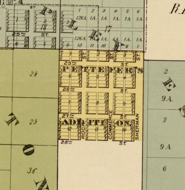
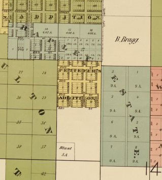
| 00:08, 11 October 2009 | Pettefers-add-map.jpg (file) |  |
38 KB | Phil | Pettefer's Addition. From Rickon, Gibb & Duff, ''Map of the City of Little Rock and Argenta, Arkansas: Compiled from Official Sources and Actual Surveys.'' Map in public domain. | 1 |
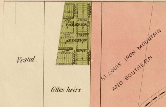
| 00:07, 11 October 2009 | Parkers-add-nlr.jpg (file) |  |
32 KB | Phil | Parker's Addition in North Little Rock, Arkansas. From Rickon, Gibb & Duff, ''Map of the City of Little Rock and Argenta, Arkansas: Compiled from Official Sources and Actual Surveys.'' Map in public domain. | 1 |
| 00:07, 11 October 2009 | Oakland-national-cem.jpg (file) |  |
30 KB | Phil | Oakland and National cemeteries in Little Rock, Arkansas. From Rickon, Gibb & Duff, ''Map of the City of Little Rock and Argenta, Arkansas: Compiled from Official Sources and Actual Surveys.'' Map in public domain. | 1 |
| 00:07, 11 October 2009 | North-argenta-map.jpg (file) |  |
55 KB | Phil | North Argenta. From Rickon, Gibb & Duff, ''Map of the City of Little Rock and Argenta, Arkansas: Compiled from Official Sources and Actual Surveys.'' Map in public domain. | 1 |
| 00:06, 11 October 2009 | Mcdiarmids-addition.jpg (file) |  |
52 KB | Phil | McDiarmid's Addition. From Rickon, Gibb & Duff, ''Map of the City of Little Rock and Argenta, Arkansas: Compiled from Official Sources and Actual Surveys.'' Map in public domain. | 1 |
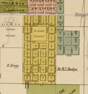
| 00:06, 11 October 2009 | Masonic-addition-map.jpg (file) |  |
31 KB | Phil | Masonic Addition. From Rickon, Gibb & Duff, ''Map of the City of Little Rock and Argenta, Arkansas: Compiled from Official Sources and Actual Surveys.'' Map in public domain. | 1 |
| 00:05, 11 October 2009 | Marshall-wolfes-addition.jpg (file) |  |
58 KB | Phil | Marshall & Wolfe's Addition. From Rickon, Gibb & Duff, ''Map of the City of Little Rock and Argenta, Arkansas: Compiled from Official Sources and Actual Surveys.'' Map in public domain. | 1 |
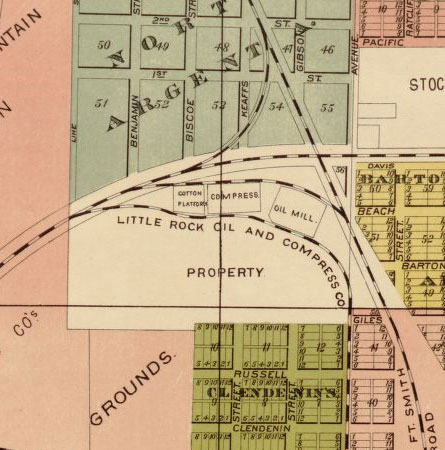
| 00:05, 11 October 2009 | Lr-oil-compress-co-map.jpg (file) |  |
55 KB | Phil | Little Rock Oil & Compress Company. From Rickon, Gibb & Duff, ''Map of the City of Little Rock and Argenta, Arkansas: Compiled from Official Sources and Actual Surveys.'' Map in public domain. | 1 |
| 00:05, 11 October 2009 | Iron-mountain-rr-grounds.jpg (file) |  |
85 KB | Phil | Iron Mountain Railroad grounds in North Little Rock, Arkansas. From Rickon, Gibb & Duff, ''Map of the City of Little Rock and Argenta, Arkansas: Compiled from Official Sources and Actual Surveys.'' Map in public domain. | 1 |
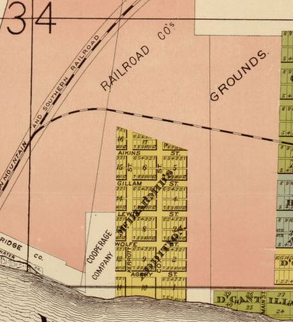
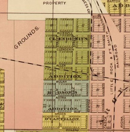
| 00:04, 11 October 2009 | Hudsons-dcantillon-addition.jpg (file) |  |
69 KB | Phil | Hudson's and D'Cantillon's additions. From Rickon, Gibb & Duff, ''Map of the City of Little Rock and Argenta, Arkansas: Compiled from Official Sources and Actual Surveys.'' Map in public domain. | 1 |
| 00:04, 11 October 2009 | Hapleys-estate-add.jpg (file) |  |
28 KB | Phil | Hapley's Estate Addition. From Rickon, Gibb & Duff, ''Map of the City of Little Rock and Argenta, Arkansas: Compiled from Official Sources and Actual Surveys.'' Map in public domain. | 1 |
| 00:04, 11 October 2009 | Hangers-addition-map.jpg (file) |  |
47 KB | Phil | Hanger's Addition. From Rickon, Gibb & Duff, ''Map of the City of Little Rock and Argenta, Arkansas: Compiled from Official Sources and Actual Surveys.'' Map in public domain. | 1 |
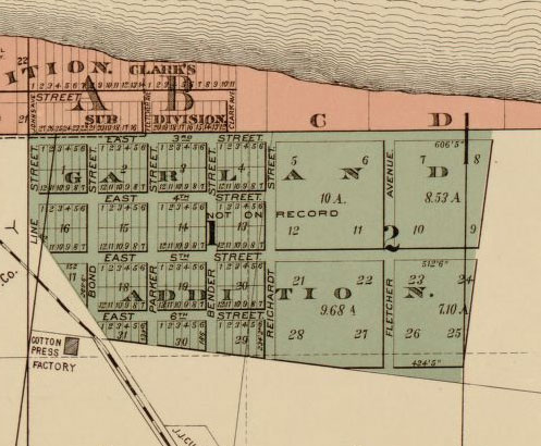
| 00:03, 11 October 2009 | Garland-addition-map.jpg (file) |  |
57 KB | Phil | Garland Addition. From Rickon, Gibb & Duff, ''Map of the City of Little Rock and Argenta, Arkansas: Compiled from Official Sources and Actual Surveys.'' Map in public domain. | 1 |
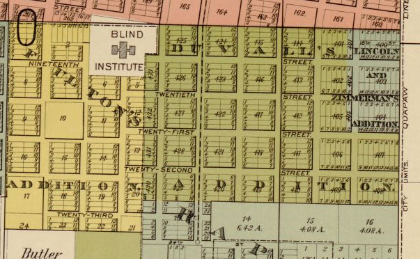
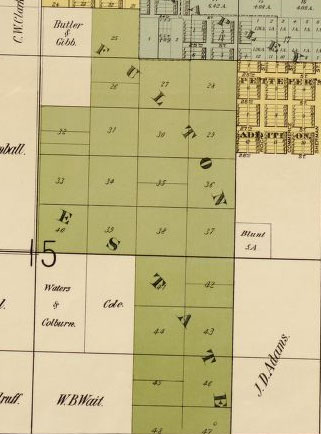
| 00:03, 11 October 2009 | Fultons-duvalls-additions.jpg (file) |  |
84 KB | Phil | Fulton's and Duvall's additions. From Rickon, Gibb & Duff, ''Map of the City of Little Rock and Argenta, Arkansas: Compiled from Official Sources and Actual Surveys.'' Map in public domain. | 1 |
| 00:02, 11 October 2009 | Fulton-estate-map.jpg (file) |  |
30 KB | Phil | Fulton Estate Addition. From Rickon, Gibb & Duff, ''Map of the City of Little Rock and Argenta, Arkansas: Compiled from Official Sources and Actual Surveys.'' Map in public domain. | 1 |
| 00:02, 11 October 2009 | Fausts-addition.jpg (file) |  |
49 KB | Phil | Faust's Addition in Little Rock, Arkansas. From Rickon, Gibb & Duff, ''Map of the City of Little Rock and Argenta, Arkansas: Compiled from Official Sources and Actual Surveys.'' Map in public domain. | 1 |
| 00:01, 11 October 2009 | East-argenta-map.jpg (file) |  |
71 KB | Phil | East Argenta. From Rickon, Gibb & Duff, ''Map of the City of Little Rock and Argenta, Arkansas: Compiled from Official Sources and Actual Surveys.'' Map in public domain. | 1 |
| 00:01, 11 October 2009 | Deaf-mute-addition.jpg (file) |  |
47 KB | Phil | The Deaf Mute Addition in Little Rock, Arkansas. From Rickon, Gibb & Duff, ''Map of the City of Little Rock and Argenta, Arkansas: Compiled from Official Sources and Actual Surveys.'' Map in public domain. | 1 |
| 00:01, 11 October 2009 | Davis-addition-nlr.jpg (file) |  |
29 KB | Phil | Davis Addition in North Little Rock, Arkansas. From Rickon, Gibb & Duff, ''Map of the City of Little Rock and Argenta, Arkansas: Compiled from Official Sources and Actual Surveys.'' Map in public domain. | 1 |
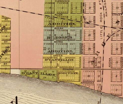
| 00:00, 11 October 2009 | Clendenins-hudsons-addition.jpg (file) |  |
60 KB | Phil | Clendenin's and Hudson's additions. From Rickon, Gibb & Duff, ''Map of the City of Little Rock and Argenta, Arkansas: Compiled from Official Sources and Actual Surveys.'' Map in public domain. | 1 |
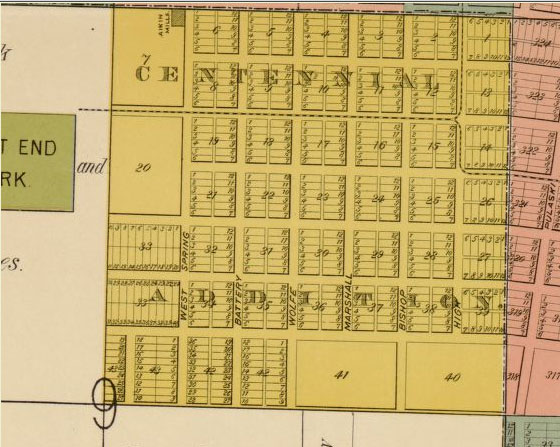
| 00:00, 11 October 2009 | Centennial-addition-map.jpg (file) |  |
74 KB | Phil | The Centennial Addition in Little Rock, Arkansas. From Rickon, Gibb & Duff, ''Map of the City of Little Rock and Argenta, Arkansas: Compiled from Official Sources and Actual Surveys.'' Map in public domain. | 1 |
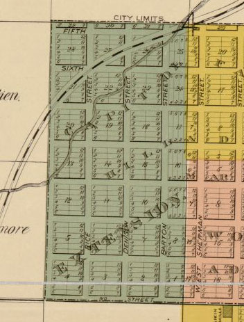
| 00:00, 11 October 2009 | Capitol-hill-extension.jpg (file) |  |
51 KB | Phil | The Capitol Hill Extension. From Rickon, Gibb & Duff, ''Map of the City of Little Rock and Argenta, Arkansas: Compiled from Official Sources and Actual Surveys.'' Map in public domain. | 1 |
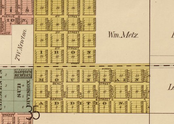
| 23:59, 10 October 2009 | Bartons-clements-maps.jpg (file) |  |
41 KB | Phil | Barton's and Clement's additions in North Little Rock, Arkansas. From Rickon, Gibb & Duff, ''Map of the City of Little Rock and Argenta, Arkansas: Compiled from Official Sources and Actual Surveys.'' Map in public domain. | 1 |
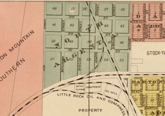
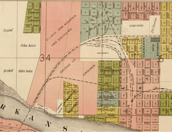
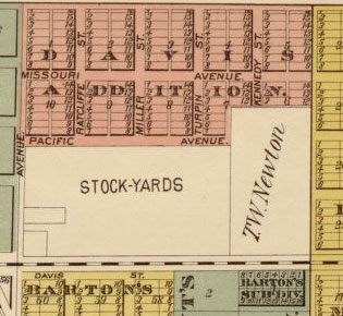
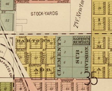
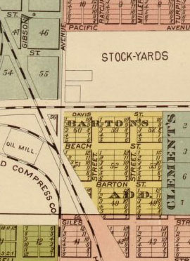
| 23:59, 10 October 2009 | Bartons-add-nlr-stockyards.jpg (file) |  |
33 KB | Phil | Barton's Addition and the North Little Rock Stockyards. From Rickon, Gibb & Duff, ''Map of the City of Little Rock and Argenta, Arkansas: Compiled from Official Sources and Actual Surveys.'' Map in public domain. | 1 |
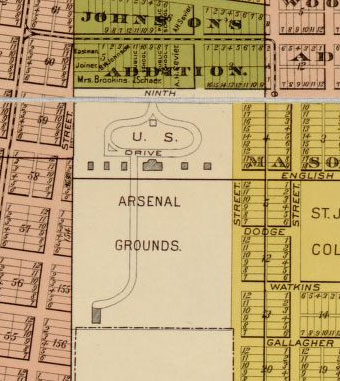
| 23:58, 10 October 2009 | Arsenal-grounds-map.jpg (file) |  |
44 KB | Phil | U.S. Arsenal grounds in Little Rock, Arkansas. From Rickon, Gibb & Duff, Map of the City of Little Rock and Argenta, Arkansas: Compiled from Official Sources and Actual Surveys. Map in public domain. | 1 |
| 23:01, 10 October 2009 | Iron-mountain-addition.jpg (file) |  |
70 KB | Phil | The Iron Mountain Addition to North Little Rock, Arkansas. From Rickon, Gibb & Duff, Map of the City of Little Rock and Argenta, Arkansas: Compiled from Official Sources and Actual Surveys. Map in public domain. | 1 |
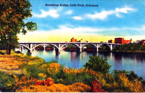
| 22:47, 10 October 2009 | Broadway-bridge-3.jpg (file) |  |
43 KB | Phil | The Broadway Bridge in Little Rock. Postcard in public domain. | 1 |
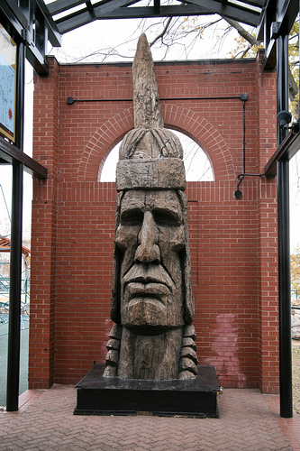
| 22:36, 10 October 2009 | Indian-head.jpg (file) |  |
132 KB | Phil | Indian Head in Julius Breckling Riverfront Park. Photo by cliff1066 on flickr. Redistributed under Creative Commons license: <div xmlns:cc="http://creativecommons.org/ns#" about="http://www.flickr.com/photos/28567825@N03/3124424654"><a rel="cc:attribution | 1 |
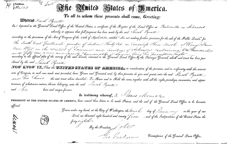
| 11:31, 6 September 2009 | Jacob-pyeatt-land-patent.GIF (file) |  |
35 KB | Phil | Land patent issued to Jacob Pyeatt on January 10, 1824. Image in public domain. See: http://www.glorecords.blm.gov/PatentSearch/Image.asp?PatentDocClassCode=STA&Accession=AR0470__.070&Format=SmallGIF&Page=1&Index=7&QryID=45177.41 | 1 |
| 10:27, 6 September 2009 | Forever-a-rose.jpg (file) |  |
98 KB | Phil | Forever Rose by Denny Haskew. Photo by cliff1066 on flickr. Redistributed under Creative Commons license. <div xmlns:cc="http://creativecommons.org/ns#" about="http://www.flickr.com/photos/nostri-imago/3123600411/in/set-72157611466496818/"><a rel="cc:attr | 1 |
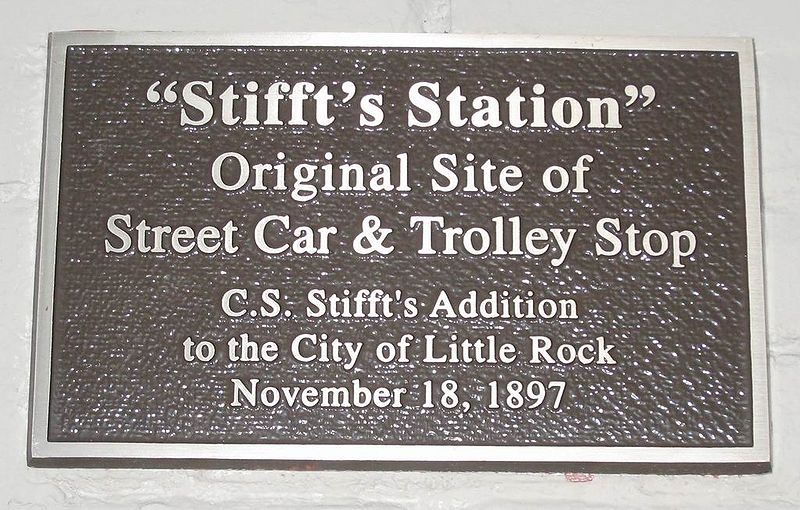
| 22:51, 5 August 2009 | Stifft-station-sign.jpg (file) |  |
118 KB | Phil | Plaque marking original location of Stifft's Station. Photo by Broooooooce. Available from Wikimedia Commons: http://commons.wikimedia.org/wiki/File:Stifft_Sign.jpg | 1 |
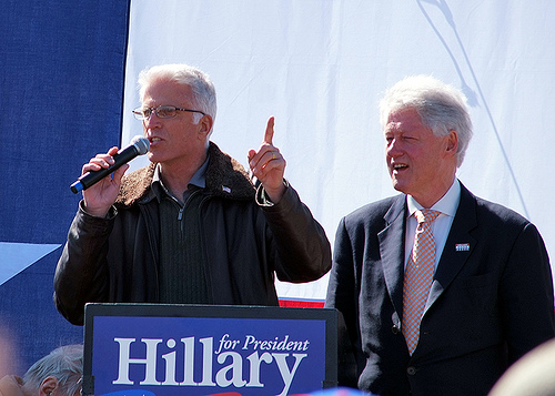
| 18:37, 16 July 2009 | Ted-danson.jpg (file) |  |
109 KB | Phil | Ted Danson with Bill Clinton at Hillary Clinton for President rally. Photo by mattscoggin on flickr. Distributed under Creative Commons license: <div xmlns:cc="http://creativecommons.org/ns#" about="http://www.flickr.com/photos/71336401@N00/2287169026"><a | 1 |
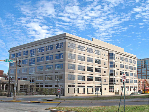
| 01:06, 10 July 2009 | Cals-main-library.jpg (file) |  |
170 KB | Phil | Main Library in the CALS system. Image by thomas23. Distributed under Creative Commons license: <div xmlns:cc="http://creativecommons.org/ns#" about="http://www.flickr.com/photos/livenow/361065143/"><a rel="cc:attributionURL" href="http://www.flickr.com/p | 1 |
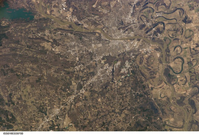
| 01:02, 10 July 2009 | Little-rock-space.JPG (file) |  |
119 KB | Phil | Little Rock-North Little Rock viewed from space. Image courtesy of the Image Science & Analysis Laboratory, NASA Johnson Space Center. ISS016-E-30700 http://eol.jsc.nasa.gov | 1 |
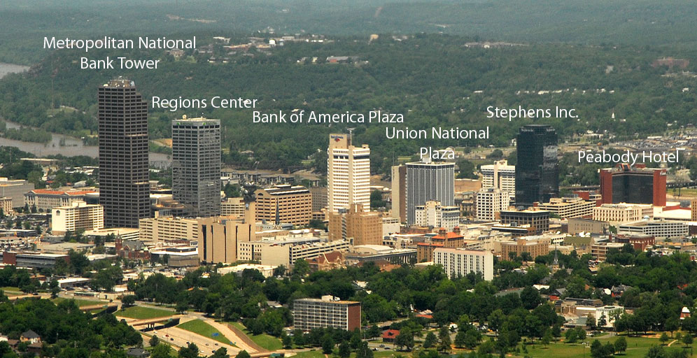
| 00:56, 10 July 2009 | Lr-skyline.jpg (file) |  |
182 KB | Phil | Little Rock skyline. Photo distributed under Creative Commons license. See http://commons.wikimedia.org/wiki/File:Littlerock.jpg | 1 |
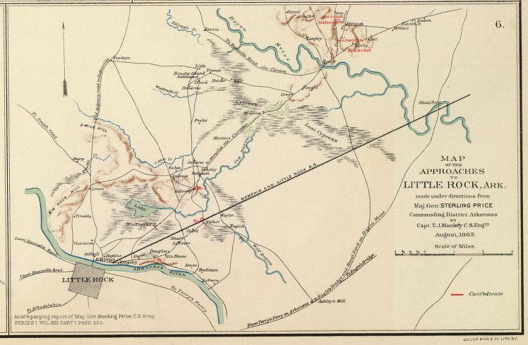
| 00:38, 10 July 2009 | Map-civil-war-lr.jpg (file) |  |
92 KB | Phil | Civil War map of Major General Sterling Price's advance on Little Rock. Map in public domain. | 1 |
| 23:57, 9 July 2009 | Community-bakery.jpg (file) |  |
194 KB | Phil | Community Bakery in Little Rock. Photo by Tuaussi on flickr. Distributed under Creative Commons license: <div xmlns:cc="http://creativecommons.org/ns#" about="http://www.flickr.com/photos/tuaussi/3618047384/"><a rel="cc:attributionURL" href="http://www.fl | 1 |