File:Arkansas-1819.jpg
From FranaWiki
No higher resolution available.
Arkansas-1819.jpg (514 × 391 pixels, file size: 49 KB, MIME type: image/jpeg)
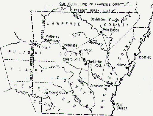
Outline map of Arkansas counties in 1819.
File history
Click on a date/time to view the file as it appeared at that time.
| Date/Time | Thumbnail | Dimensions | User | Comment | |
|---|---|---|---|---|---|
| current | 21:29, 19 February 2010 | | 514 × 391 (49 KB) | Phil (talk | contribs) | Outline map of Arkansas counties in 1819. |
- You cannot overwrite this file.
File usage
The following 2 pages link to this file: