Difference between revisions of "Arkansas River"
From FranaWiki
| Line 1: | Line 1: | ||
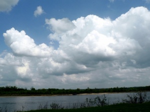
[[Image:P1040521 1.jpg|thumb|The Arkansas River. Photo by Megan Davari.]] | [[Image:P1040521 1.jpg|thumb|The Arkansas River. Photo by Megan Davari.]] | ||
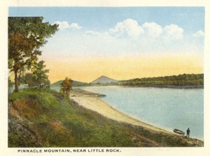
[[Image:Pinnacle-mtn-postcard.jpg|thumb|Historic postcard view of Arkansas River with Pinnacle Mountain in distance.]] | [[Image:Pinnacle-mtn-postcard.jpg|thumb|Historic postcard view of Arkansas River with Pinnacle Mountain in distance.]] | ||
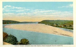
| − | [[Image:Ark-river-postcard.jpg|Historic postcard view of sandbar in Arkansas River.]] | + | [[Image:Ark-river-postcard.jpg|thumb|Historic postcard view of sandbar in Arkansas River.]] |
The '''Arkansas River''' is the sixth longest river in the United States (1,469 miles). At Little Rock the river is part of the [[McClellan-Kerr Arkansas River Navigation System]] operated by the Army Corps of Engineers. | The '''Arkansas River''' is the sixth longest river in the United States (1,469 miles). At Little Rock the river is part of the [[McClellan-Kerr Arkansas River Navigation System]] operated by the Army Corps of Engineers. | ||
Revision as of 00:50, 15 February 2009
The Arkansas River is the sixth longest river in the United States (1,469 miles). At Little Rock the river is part of the McClellan-Kerr Arkansas River Navigation System operated by the Army Corps of Engineers.
Along the river in downtown Little Rock is the historic landmark La Petite Roche ("the little rock") from which the city derives its name.


